(04)City operations centre · West Africa
Lagoon OS
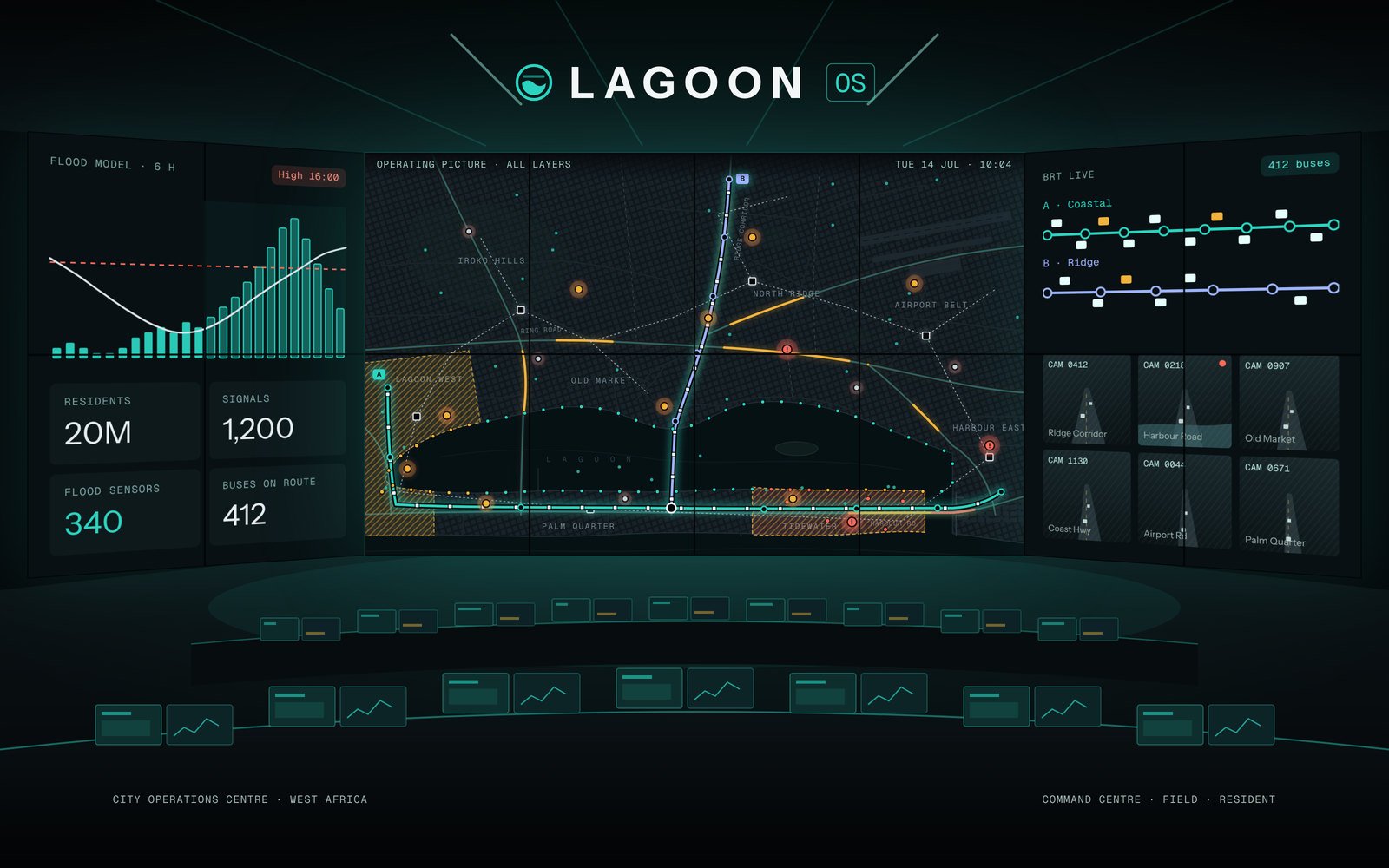
One operating picture for a coastal megacity of 20 million — traffic, buses, flood sensors, power and incidents on one map, with AI that forecasts flooding six hours ahead and retimes 1,200 traffic signals.
(01)The challenge
Every rainy season the lagoon districts flooded, and every department saw only its own slice — traffic on one screen, drains on another, buses on a third.
The city wanted one room where operators could see the whole city, act before the water rose and send crews to the right street.
(02)Our approach
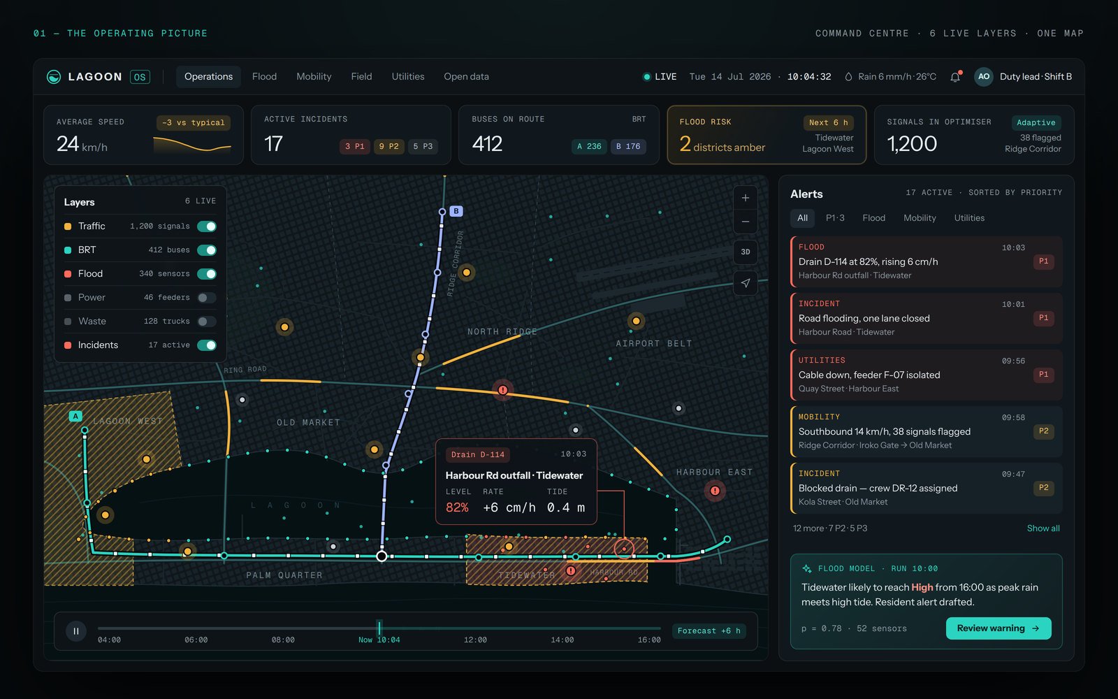
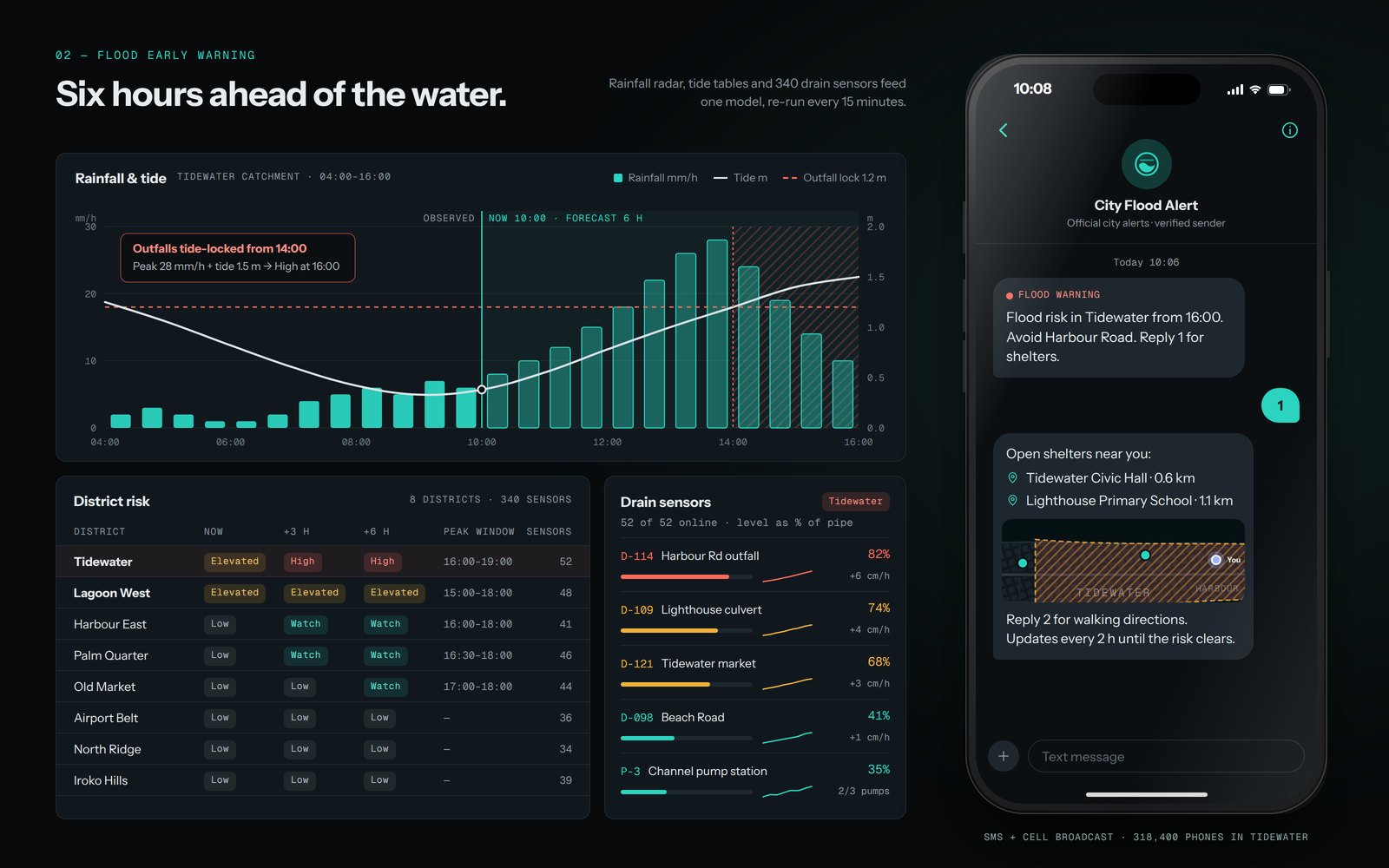
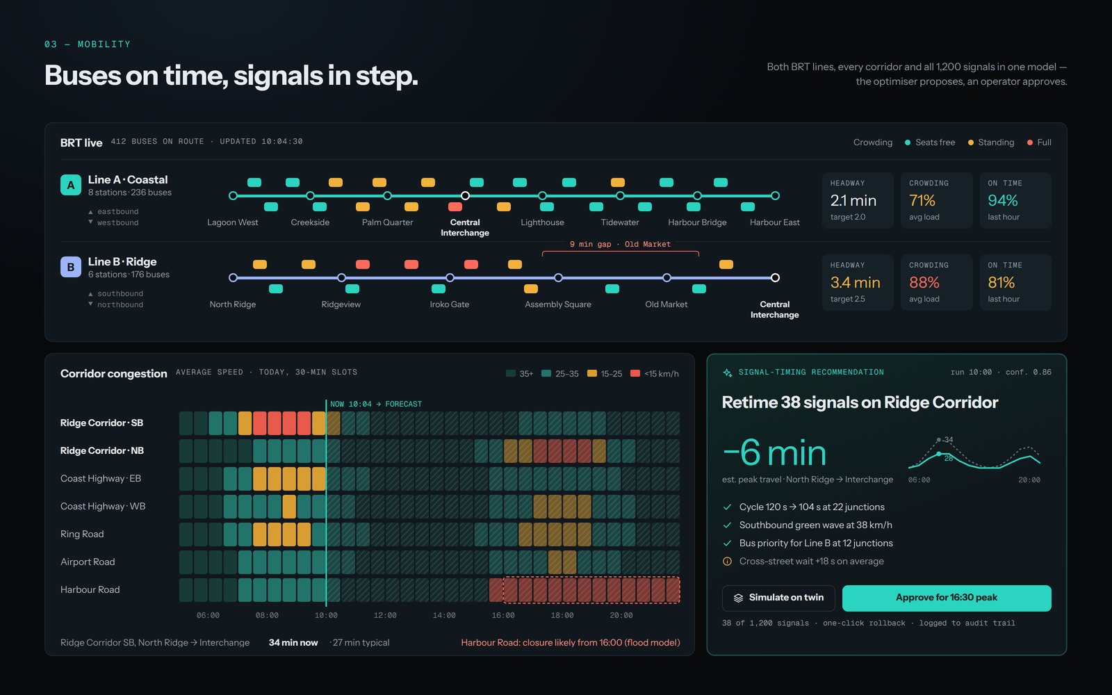
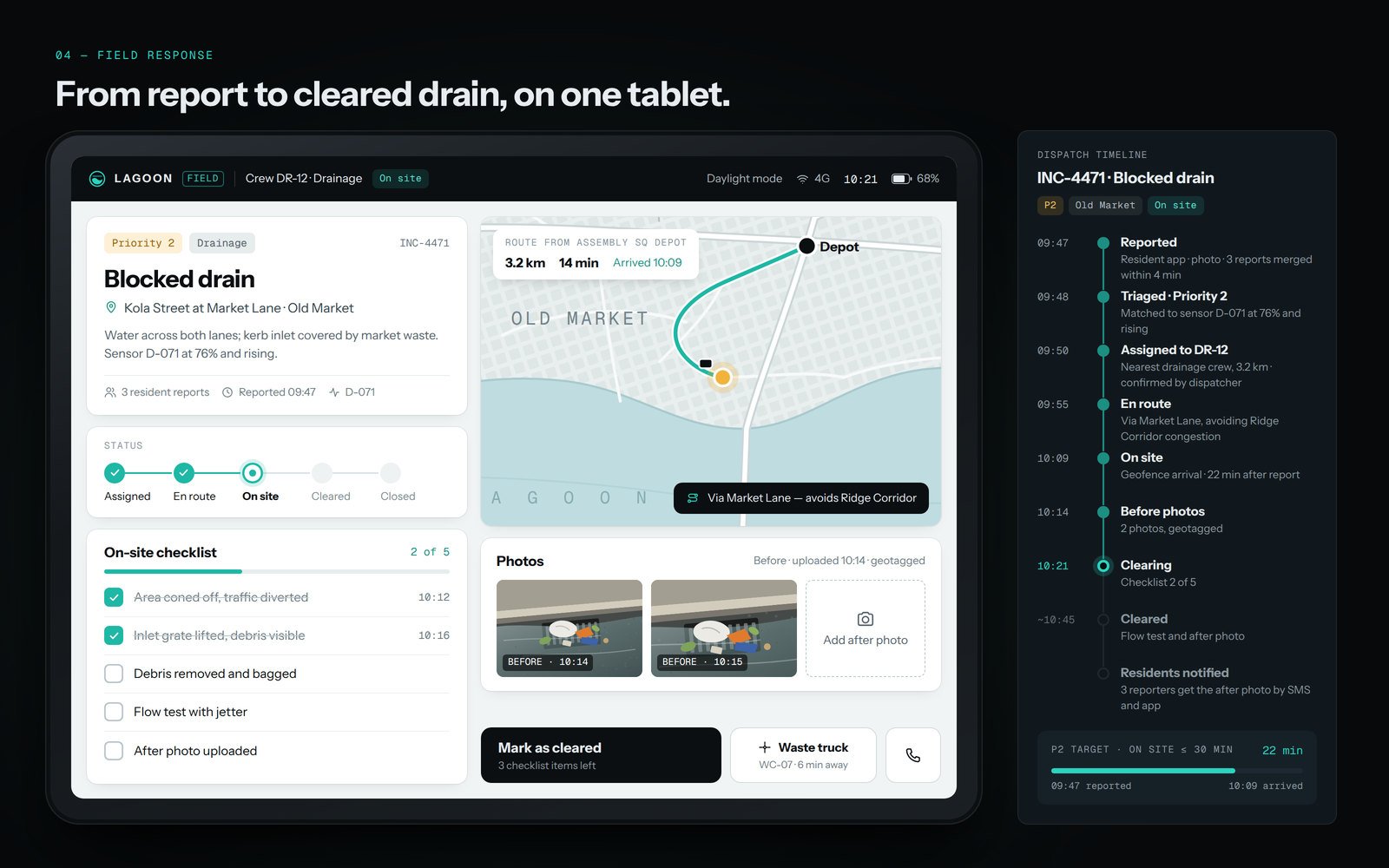
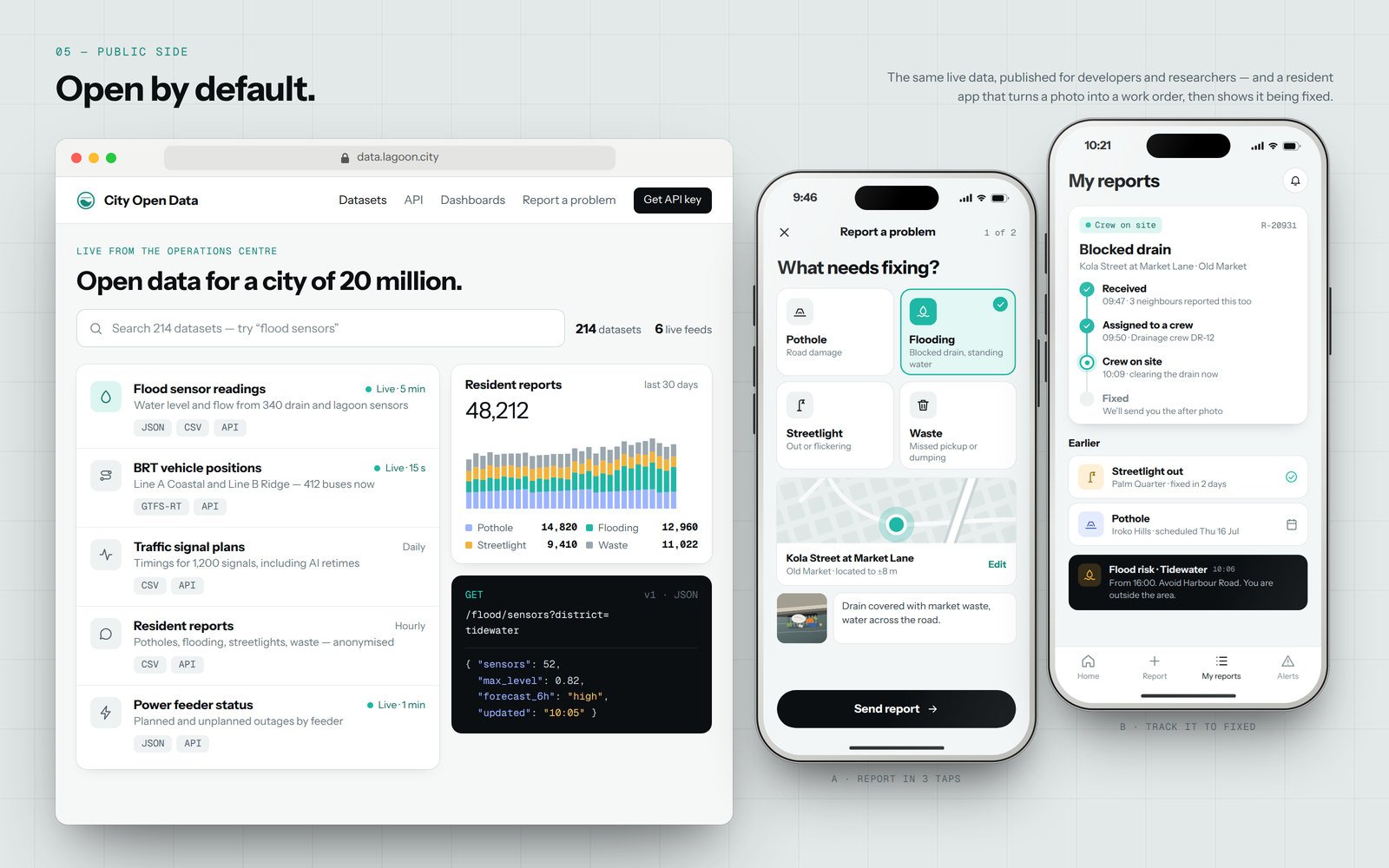
We designed Lagoon OS around six live layers on one map. A flood model combines rainfall, tide and 340 drain sensors to forecast risk by district six hours ahead and drafts the SMS warning to residents. A signal optimiser proposes new timings for whole corridors, which operators approve with one tap. Field crews work from a rugged tablet app, and residents get an open-data portal and a “report a problem” flow that shows each report being fixed.
(03)Frame by frame
02 / 05
(04)What we delivered
Live data layers on one map
Signals in the optimiser
Apps — command centre, field & resident
Next project(05 / 26)
Start a project
Let's build something iconic.
Tell us where you want to be in twelve months. We will show you how to get there.
Start a projectOr write to us directly
hello@voyarx.com